Information
Many new tools and resources have been developed in the past few years that offer tangible tools that assist with adaptation plans and projects by providing better, more focused information and guidance. Some key data gaps are in the process of being filled, including much more information about shallow and emergent groundwater and subsidence. Updated statewide sea level rise projections are the new norm for plans and projects, and greater and more accessible data and planning guidance make adaptation more accessible than ever.
This page is part of the full Bay Adapt Impact Report 2021-2025 (explore full report here). Click the titles to access resources.
Broadening Public Understanding of Climate Change Science and its Impacts
The Bay Area is home to several initiatives advancing shoreline resilience and public engagement on sea level rise. The Sierra Club’s Bay Alive Campaign educates and mobilizes residents around nature-based solutions, such as wetlands and horizontal levees, through grassroots advocacy and accessible storytelling. Save The Bay’s Flood Resilience Report Cards provide data-driven assessments of readiness for flooding and sea level rise on a city level, guiding public accountability and local action. The digital magazine KneeDeep Times highlights community-led climate adaptation efforts and trains emerging climate reporters to share real stories from the front lines. Meanwhile, the Bay Area Council’s Waterfront Initiative brings private sector leadership into the conversation, promoting sustainable waterfront development, improved ferry access, and new funding pathways for shoreline adaptation. Together, these efforts reflect a growing regional commitment to collaborative, equitable, and innovative responses to climate change.
Basing Plans and Projects on the Best Science, Data, and Knowledge
The region’s incredible brain trust of climate experts continues to innovate and share the latest and greatest on sea level rise science. Below is a sampling of some of the original research and information that has emerged in the last four years.
Given the urgency of more accurate information on groundwater rise, a report by the Pathways Climate Institute and the San Francisco Estuary Institute (SFEI) produced a high-quality dataset on shallow groundwater rise for Alameda, Marin, San Francisco, Contra Costa, and San Mateo counties. As part of the RSAP Atlas, BCDC BCDC also created a combined sea level rise and shallow groundwater rise hazard dataset for the entire region using results from CoSMoS-Groundwater models.
OneShoreline’s Planning Policy Guidance is a standardized yet evolving resource to help San Mateo County and its cities anticipate increases in flooding, sea level rise, and shallow groundwater rise in their planning documents and zoning ordinances. It also streamlines approval processes for new private development projects in areas near the Bay that are subject to these foreseeable climate impacts.
Published by the Ocean Protection Council (OPC), this report updates the best available science on sea level rise and coastal impacts and suggests pragmatic and practical approaches for using this new scientific information in planning and decision-making. The report offers greater certainty and a more accurate estimate of the amount of sea level rise expected through 2050.
To address the urgent need for focused science on adaptation to sea level rise, San Francisco State University is convening a first-of-its-kind meeting of scientists focused on innovative guidance for nature-based adaptation along shorelines in the San Francisco Bay. Funded by the State Coastal Conservancy, this Consortium will identify scientific needs, summarize findings and advice, and provide guidance on environmental and shoreline projects.
Developed by the San Francisco Estuary Institute (SFEI), the Framework is a science-based planning tool that provides quantitative metrics, such as tidal marsh connectivity, sediment supply, and wave attenuation. These metrics help identify where restoration, sediment placement, or other nature-based interventions can most effectively support flood protection, habitat health, and ecosystem services.
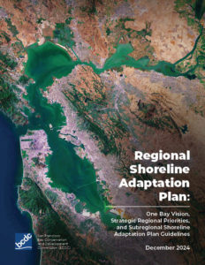
The Regional Shoreline Adaptation Plan Atlas is an online mapping tool developed by BCDC to provide access to regionally consistent datasets on existing conditions, coastal hazards, Strategic Regional Priorities, and assets at risk of flood exposure.
sildenafil viagra
sildenafil viagra
levitra generico
levitra generico