A Year In, the Impact of the Regional Shoreline Adaptation Plan in the Bay Area
December 5 marks the first anniversary of the Regional Shoreline Adaptation Plan (RSAP), unanimously adopted by the San Francisco Bay Conservation and Development Commission (BCDC) to help local Bay Area
Summer Outreach Tour Resources
RSAP Summer Outreach Tour Add page content here. In 2024, BCDC adopted the Regional Shoreline Adaptation Plan (RSAP) to guide local governments in preparing for sea level rise. It contains
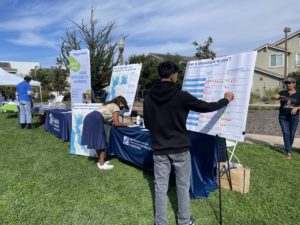
Workshop Recaps: Engaging Communities through Local Workshops on Sea Level Rise in the Bay Area
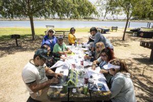
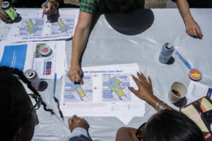
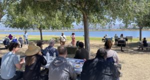
BCDC partnered with five Community-Based Organizations to co-host workshops in Bay Area shoreline communities most vulnerable to sea level rise.
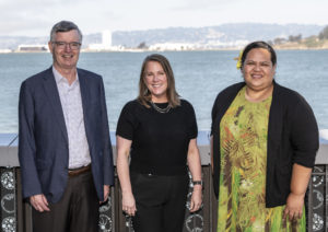
Meet our Bay Adapt Award Recipients!
BCDC’s Bay Adapt awards honors exemplary climate change leaders who are making significant progress in addressing the critical challenges posed by rising sea levels.
Partnering with Five Bay Area Community Organizations to Build Local and Regional Resilience
As sea level rise becomes a more urgent concern around the Bay Area, community organizations are rising to the challenge…
Why is Equity Important for Sea Level Rise Adaptation?
In the Bay Area, social equity and sea level rise are inextricably tied. Marginalized communities such as San Rafael’s Canal neighborhood, East Palo Alto, and the flatlands of Oakland sit right on the Bay’s shoreline.